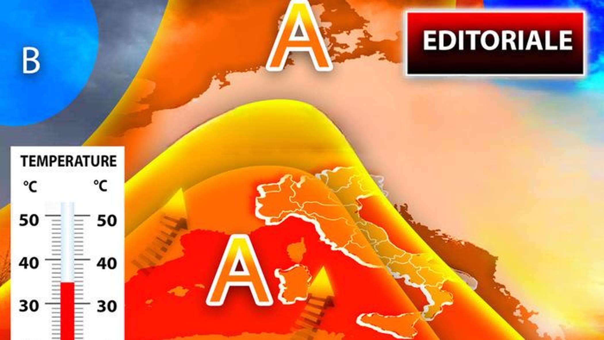
An approaching anticyclone is set to bring stable, high-temperature conditions across the Italian Peninsula starting this week. According to recent meteorological modeling, the high-pressure system will suppress cloud cover and trigger a significant rise in temperatures, potentially impacting heat-sensitive sectors such as agriculture and public health throughout the Mediterranean region.
The transition toward a more stable weather pattern marks a departure from previous unsettled conditions. Meteorological data indicates that a large ridge of high pressure is moving into position over the central Mediterranean, which will effectively block incoming Atlantic disturbances. This shift is expected to result in clear skies and minimal precipitation for much of the country over the coming days.
Weather analysts note that this period of atmospheric stability is characteristic of the strengthening high-pressure systems often seen during the transition into the summer months. While the immediate impact is a rise in daily temperatures, the duration and intensity of the anticyclone will determine whether this develops into a sustained heatwave.
What is driving the upcoming heat in Italy?
The primary driver of the anticipated warming is the intensification of an anticyclone, a large-scale weather system characterized by high atmospheric pressure at its center. As air descends within an anticyclone, it warms through compression, which prevents the formation of clouds and suppresses the upward movement of air necessary for precipitation. This process creates a “cap” over the region, leading to the clear, sunny conditions reported by meteorologists.

According to the Aeronautica Militare, Italy’s official air force weather service, the positioning of this high-pressure cell will influence air circulation patterns across the entire Peninsula. As the system strengthens, it will pull warmer air masses from the south, further elevating temperatures in both coastal and inland areas. This mechanism is a standard driver for heat events in the Mediterranean basin.
The European Centre for Medium-Range Weather Forecasts (ECMWF) has also modeled these shifts, showing a widening area of high pressure that is expected to remain stationary for several days. This stability is what meteorologists refer to as a “blocking” pattern, which can prevent cooler, more turbulent weather from moving in from the north, thereby prolonging the period of heat.
How high will temperatures climb across the Peninsula?
Temperature increases are expected to vary by region, though a general upward trend is projected for the entire country. In northern Italy, the warming will likely be gradual as the anticyclone establishes itself, with daytime highs rising significantly above the seasonal average in the Po Valley. Areas such as Lombardy and Veneto are expected to see a marked increase in thermal stability.
Central Italy, including Rome and the surrounding Lazio region, will likely experience more immediate effects of the high-pressure system. Meteorologists suggest that the combination of direct solar radiation and the descending air of the anticyclone will lead to higher-than-average afternoon temperatures. This area is often a primary zone for the initial impact of Mediterranean high-pressure cells.

The southern regions and the islands, including Sicily and Sardinia, are anticipated to see the most intense heat. These areas are more susceptible to the influx of warm air from North Africa, which often accompanies an anticyclone in the Mediterranean. In these locations, temperatures may reach levels that trigger local heat advisories if the system persists without significant wind to provide relief.
Current projections suggest the following temperature trends:
- Northern Italy: Moderate warming with clear skies and low humidity.
- Central Italy: Significant temperature increases and high solar radiation.
- Southern Italy and Islands: Potentially extreme heat with high thermal stress.
What are the primary risks associated with this weather shift?
The sudden transition from unstable to high-heat conditions presents several challenges for different sectors of society. Public health officials often monitor these shifts closely, as rapid temperature rises can impact vulnerable populations, including the elderly and those with pre-existing cardiovascular conditions. The lack of nighttime cooling, often seen during intense anticyclonic periods, can exacerbate these risks.
In the agricultural sector, the stability and heat bring concerns regarding soil moisture levels. While the lack of rain is beneficial for certain harvesting schedules, the increased evaporation rates caused by high temperatures can lead to rapid dehydration of crops. Farmers in the Mediterranean basin frequently manage these risks through optimized irrigation schedules to combat the stress placed on plants during high-pressure events.
Energy demand is another critical factor. As temperatures rise, the demand for air conditioning and cooling systems increases significantly. This can place additional strain on the electrical grid, particularly during peak afternoon hours. Utility providers typically prepare for these fluctuations by monitoring regional consumption patterns and ensuring grid stability during heat-related surges.
The following table summarizes the anticipated impact across key sectors:
| Sector | Primary Impact | Mitigation Factor |
|---|---|---|
| Public Health | Increased risk of heat exhaustion | Hydration and shade |
| Agriculture | Soil moisture depletion | Irrigation management |
| Energy | Higher cooling demand | Grid load management |
| Tourism | Increased outdoor activity | Heat advisories |
Why does this weather pattern matter for the summer season?
The emergence of a strong anticyclone at this stage of the season serves as an indicator of the broader climatic trends affecting the Mediterranean. Meteorologists look at these early-season high-pressure systems to gauge the potential intensity of the upcoming summer months. A persistent anticyclone can set a precedent for a season characterized by prolonged heatwaves and drought conditions.
Comparing this current pattern to previous years, the speed at which the anticyclone establishes itself is a key metric. Rapid stabilization can catch local infrastructure and agricultural planning off-guard. When high-pressure systems arrive earlier or with more intensity than the historical average, the cumulative effect on water reservoirs and groundwater levels becomes a significant concern for regional planners.
Furthermore, the interaction between the anticyclone and the surrounding sea temperatures plays a vital role. As the Mediterranean waters warm, they can feed more energy into the atmosphere, potentially intensifying the heat felt on land. This feedback loop is a central focus for climate researchers studying the Mediterranean’s changing weather dynamics.
Key Takeaways:
- An anticyclone is moving into the Mediterranean, bringing stable and hot weather to Italy.
- High pressure will suppress rain and cloud cover, leading to increased solar radiation.
- Southern Italy and the islands are expected to experience the highest temperature increases.
- Risks include increased heat-related health concerns, agricultural water stress, and higher energy demands.
The next official meteorological update from the Aeronautica Militare is expected within the next 24 to 48 hours, which will provide more precise temperature figures and a detailed regional breakdown. Residents and businesses are encouraged to monitor local weather advisories for specific heat warnings.
What are your experiences with recent temperature shifts in your region? Share your thoughts and updates in the comments below and share this article with those who need to stay prepared.
Keep reading